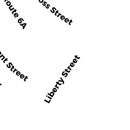
25 LIBERTY STREET
Owner Information
ABROFF FAMILY TRUST
10 IVY WAY
PORT WASHINGTON, NY 11050


Property Details
25 LIBERTY STREET is classified as a Single Family Residential (Cape).
The primary structure on this property was built in 1857. There are 1,155ft2 of built area within this property. There is 1,155ft2 of residential/living space within this property. This property is listed as having 7 rooms.
25 LIBERTY STREET is valued at $315,300. The land is valued at $141,800 and the structures are valued at $171,500. There is an additional valuation of $2,000 on this property.
This property is in Zone VIL. Confirm with local Zoning Board authorities to ensure there are no overlays or other easements on this property.
The most recent deed for 25 LIBERTY STREET is recorded at the local registrar in Book 32070, Page 216. 25 LIBERTY STREET was last sold on Thursday, June 6, 2019 for $100.
Assessment data from fiscal year 2022.
Flood Data
According to the FEMA National Flood Hazard Layer, this property does not appear to be in a flood zone. It may also be in an area not yet reviewed. Nonetheless, confirm this information prior to taking any action.
To view the flood hazards around this property, create a FEMA "Firmette" Map of the area around 25 LIBERTY STREET.
Broadband Internet Providers
| Provider | Type | Bandwidth (mbps) | |
|---|---|---|---|
| Verizon New England Inc. | DSL | 5 | 0 |
| HughesNet | Satellite | 25 | 3 |
| GCI Communication Corp. | Satellite | 0 | 0 |
| T-Mobile | Fixed Wireless | 25 | 3 |
| Viasat Inc | Satellite | 35 | 3 |
| VSAT Systems, LLC. | Satellite | 2 | 1 |
| Comcast | Cable | 1000 | 35 |
Broadband service provider data from December 2020.
Adjacent Properties
- 11 CROSS STREET
Single Family Residential owned by HOXIE, EDWARD W JR & JEAN MARIE - 9 CROSS STREET
Single Family Residential owned by CURRIER, CATHERINE R - 27 LIBERTY STREET
Single Family Residential owned by DECONTE, GERARD L & TERRY SEARL - 0 JARVES STREET
Undevelopable Residential Land owned by DECONTE, TERRI SEARL